weex-amap

首次使用请执行:
weexplus plugin add https://github.com/farwolf2010/amap
https://lbs.amap.com/faq/top/hot-questions/249 申请完apiKey之后,请在按如下方式初始化
     <weex-amap style="flex: 1;background-color: red" :sdkKey="{ios:'05df62dbb56a7257048679f5618cb63d','android':'1edf8a80f0e423233c0b2db26398238b'}" :center="point.position" >
        </weex-amap>
快速开始
编辑你的weex文件
<template>
    <div style=" background-color: #00B4FF">
        <weex-amap style="flex: 1;background-color: red" :sdkKey="{ios:'05df62dbb56a7257048679f5618cb63d','android':'1edf8a80f0e423233c0b2db26398238b'}" :center="point.position" >
            <weex-amap-marker :position="point.position" :title="point.title"></weex-amap-marker>
        </weex-amap>
        <button @click="init"></button>
    </div>
</template>
<script>
    export default{
        data(){
            return {
                pos:[125.487, 40.00003],
                point: {
                    position: [112,36],
                    title: 'this is a marker'
                }
            }
        },
        props: {},
        methods: {


        },
        created(){
            this.init()
        }
    }
</script>
<style scoped>

</style>
API
weex-amap 属性
| 属性 | 类型 | Demo | 描述 | |
|---|---|---|---|---|
| sdkKey | object | {ios:'xxx',android: 'xxx',h5: 'xxx'} | 指定开发者的 SDK 密匙 | |
| scale | boolean | true | 设置比例尺功能是否可用 | |
| center | array | [116.487, 40.00003] | 传入地理位置坐标[x,y] 默认为当前定位位置 | |
| zoom | number | 合法值范围 [3,19] | 缩放级别 | |
| compass | boolean | true | 是否允许显示指南针 | |
| zoomEnable | boolean | true | 是否允许缩放 | |
| marker | array | [{position:[116,12]}] |
点标记物的属性 | |
| geolocation | boolean | true | 是否显示当前位置 | |
| zoomPosition | String | center | bottom | 设置缩放按钮的位置 |
| gestures | String | ["zoom","rotate","tilt","scroll"] | 设置允许对地图做哪些手势操作 | |
| myLocationEnabled | boolean | true | 定位按钮是否显示 | |
| showMyLocation | boolean | true | 是否显示当前位置 | |
| customEnabled | boolean | true | 是否开启自定义地图样式 | |
| setMapCustomEnable | String | {"android":"/data/custom_map"} | 设置自定义地图资源文件的路径 | |
| indoorswitch | boolean | false | 设置室内地图楼层切换控件是否可见 |
建议你前往高德开发者社区申明你对应产品的Key,保证地图正常工作
weex-amap 事件
zoomchange
用户缩放地图时触发该事件
事件格式
{
  "targetCoordinate" : "缩放后的位置",
  "zoom" : "目标可视区域的缩放级别。",
  "tilt" : "目标可视区域的倾斜度,以角度为单位。",
  "bearing" : "可视区域指向的方向,以角度为单位,从正北向逆时针方向计算,从0 度到360 度。",
  "isAbroad" : "该位置是否在国内(此属性不是精确计算,不能用于边界区域)",
  "scalePerPixel" : "Weex中一像素对应实际距离的长度(单位米)",
  "visibleRegion" : "可视区域的范围"
}
dragend
用户拖动地图时触发该事件
weex-amap-marker 属性
| 属性 | 类型 | Demo | 描述 |
|---|---|---|---|
| position | array | [116.487, 40.00003] | 传入地理位置坐标[x,y] 默认为当前定位位置 |
| icon | string | some_icon_url | 图标的url地址 |
| title | string | 'this is a marker' | 坐标点的名称 |
| hideCallout | boolean | true | 设置marker是否可点击 |
| open | boolean | true | 是否显示InfoWindow |
weex-amap-marker 事件
click
点击marker时触发
weex-amap-info-window 属性
| 属性 | 类型 | 描述 |
|---|---|---|
| open | boolean | 是否显示InfoWindow |
| position | String | InfoWindow位置 |
| offset | String | InfoWindow偏移量 |
weex-amap-circle 属性
| 属性 | 类型 | 描述 |
|---|---|---|
| center | String | 中心点 |
| strokeColor | String | 描边颜色 |
| fillColor | String | 填充颜色 |
| strokeWidth | float | 描边宽度 |
| radius | float | 半径 |
weex-amap-polygon 属性
| 属性 | 类型 | 描述 |
|---|---|---|
| path | String | 路径 |
| strokeColor | String | 描边颜色 |
| fillColor | String | 填充颜色 |
| strokeWidth | float | 描边宽度 |
weex-amap-polyline 属性
| 属性 | 类型 | 描述 |
|---|---|---|
| path | String | 路径 |
| strokeColor | String | 描边颜色 |
| strokeStyle | String | 描边样式,可为dashed或空 |
| strokeWidth | float | 描边宽度 |
Amap 模块
getUserLocation(completeFunc,errorFunc)
- completeFunc 定位成功后的回调函数,返回的数据:
{
data:{
  position: []
},
result: 'success'
}
getLineDistance(posA, posB, callback)
- 获取两点间的直线距离
polygonContainsMarker(position, id, callback)
- 判断点是否在合围范围内
一款高德地图weex插件,当前版本支持定位,缩放等地图常用操作。
请配合高德地图开发文档使用该插件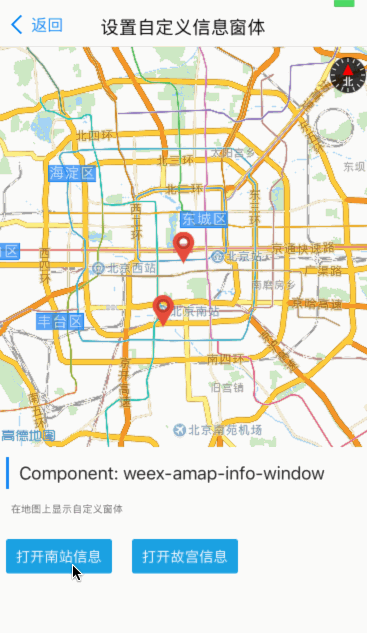
集成插件
如何将地图插件集成到自己的项目呢,请参考weexpack文档说明